#Adventure: This left me absolutely speechless
Or what happened when I visited Missouri's lowest point and highest point on consecutive days
If you enjoy this newsletter, please consider recommending it to others and becoming a paid subscriber. You’ll get dispatches about travel, adventure and #dadlife that will sometimes be heartfelt and profound, sometimes peel back modern parenting life for a look inside, and sometimes be, well, whatever this is. If you support my work, I would appreciate it.
This is the fourth in an series of stories about visiting a state’s highest elevation point. The other three are here (Maine), here (North Carolina) and here (Tennessee). This story appears in the current issue of Missouri Life.
From the bottom to the top
I arrived near Missouri’s lowest elevation point on a hot Sunday afternoon. Except for drivers zipping along an adjacent highway that crosses the St. Francis River, it was deserted. Which was not surprising, because while amateur and veteran adventures alike wax poetic about conquering a state’s highest peaks, nobody ever brags about visiting a state’s lowest point.
But life is about bouncing between highs and lows and how we handle everything in between, so I spent two days on an adventure I called the Lowest of Lows and the Highest of Highs. I visited Missouri’s lowest point—on the St. Francis banks bordering Arkansas—and its highest point—Tom Sauk Mountain.
Or tried to, at least.
It’s easy to find the highest point in Missouri. There’s a parking lot and signs and a sidewalk that leads you right to a plaque demarking the Show Me State’s top. The lowest point, as far as I can tell, has none of that.
All we have is a USGS report that names the banks of the St. Francis in Dunklin County as Missouri’s nadir. But where, exactly, Missouri drops to 230 feet above sea level the USGS report doesn’t say (nor does it give the precise location for the other 49 states’ low points).
Using a Google app that reports elevation, I found several spots at that elevation and chose to visit the most accessible. I pulled off U.S. 412 and parked on an abandoned levee road. I got out, started walking and immediately thought, uh-oh.
Trees that normally stood on dry land were instead in what appeared to be a couple feet of water. I could get close to, but not stand exactly on, the Lowest of Lows.
Thus ended attempt No. 1 to reach the lowest spot.
Undeterred, I drove over a bridge into Arkansas and stopped at a boat launch. I hoped to put on waders and walk across the river to get to another spot that Google reported was very low, though admittedly it might have been slightly above 230. High water made that impossible, too.
Two tries, two failures.
As a last-ditch effort, I drove back to Missouri, walked along the highway and turned left under a bridge … but again, excess water blocked my way.
I called that strike three.
I was out.
It’s a trick of language that both a flood and a drought serve as metaphors for Lowest of Lows. But only one of them made it impossible for me to stand on the lowest elevation spot in Missouri.
While crouched under the bridge, I fumed. I would have to settle for being close, even very close, even within eyesight, of the lowest point. I don’t like settling. Oh, the irony of feeling low for failing to reach the Lowest of Lows.
But are you ready for convoluted logic? I was happy to be disappointed because I had planned all along to use the lowest elevation point to write about struggles, hardship, challenges in life and how to fight through them. I needed to fail so I could write about getting over it.
So the Lowest of Lows and the Highest of Highs was going terrible and great at the same time and for the same reason.
I left Cardwell to drive to Johnson’s Shut-Ins, the state campground that served as home base for my hike to the top of Tom Sauk. Doubt rode shotgun. Should I have looked harder for the Lowest of Lows? Should I have gone somewhere else on the river?
I didn’t have good answers. I pressed on because that’s the only way to endure low points in life. Flatlands turned to hills. Hills turned to mountains. The depths of Dunklin County disappeared behind me, and my disappointment faded along a stretch of U.S. 21 that cuts through a forest.
Just as I started to think, “this beauty redeems the Lowest of Lows,” something so amazing, so beautiful, so intimate happened that I almost don’t want to tell you for fear of failing to capture it.
But first I need to tell you about my journey to the top of Missouri.
--
I woke up in my tent at Johnson’s Shut-Ins baffled at the traffic noise. I was too far from any highway for it to be that loud. It took me several minutes to realize that droning was not cars on a distant highway but cicadas in distant trees.
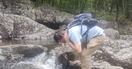
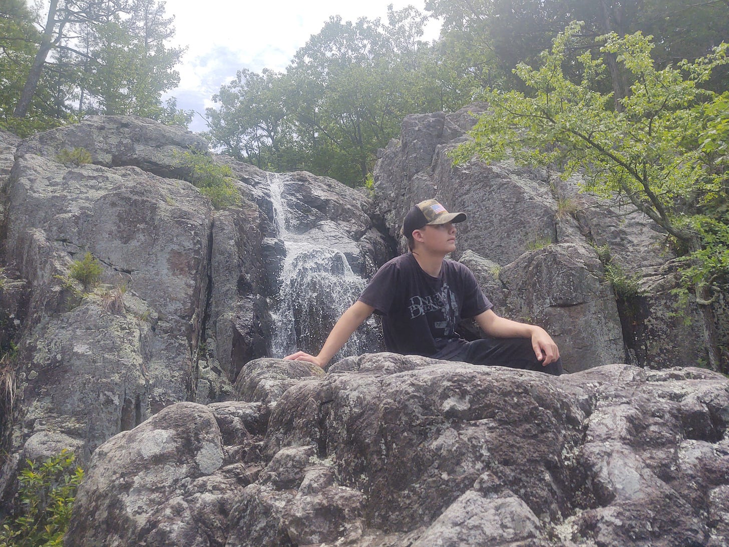
My friend Micah (F3 Rootworm, that’s him soaking himself), his son 14-year-old Shepherd (F3 Yellowstone, sitting on rock) and I chose a nine-mile loop to hike to Missouri’s high point—Tom Sauk Mountain, 1,773 feet above sea level. We could have driven there and walked to it in about five minutes. But what fun would that be?
We called out “glade!” every time we walked through one. We carefully stepped on rocks at creek crossings. After initially walking around abundant mud, we gave up on that and just tromped through it. We paused at openings as lush green valleys unrolled in front of us.
Finally, a sign told us to turn right to get to the high point.
Our arrival was, admittedly, anti-climactic. The rocky and skinny trail became gravel and wide became a sidewalk. While a placard marks Missouri’s highest spot, the eye-test strongly suggests the placard could have been anywhere in sight.
It’s the top, yes, but not a peak.
Deep in an oak forest, we celebrated our accomplishment—peak or not, it’s not every day that you climb the tallest mountain in a state. It was a moment that demanded to be savored, so savor it we did. We sat on a bench, made coffee, divvied up a sausage and enjoyed lunch closer to the sun than anybody else in the entire state.
It was fitting that we had a common lunch here, because the beauty of Missouri’s highest point is how common it is. Missouri has thousands of acres just like this—trees as far as the eye can see. This one just happens to also be the high point of the state.
We left the high point and joined the Mina Sauk Falls Trail. Signs warned of a rocky, arduous, even dangerous trail, and our grunting and groaning proved worthy of that. We arrived at Mina Sauk Falls worn out.
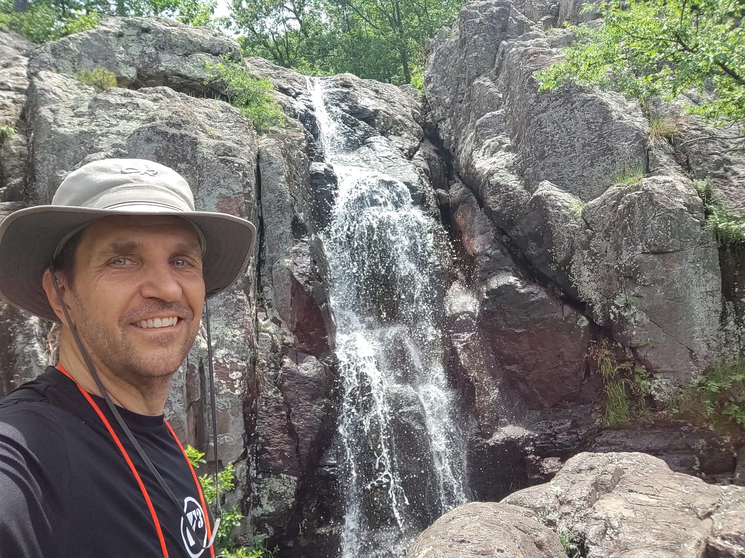
The tallest in the state, Mina Sauk Falls drop 132 feet through a series of ledges. Starting high above me and ending far below me, Tom Sauk Creek flowed down, down, down, carving its way through ancient gray rocks before collecting in a pool where two hikers appeared to be filming themselves swimming.
Dry days reduce the falls to a trickle. On this day the creek gushed down. I thought again about droughts and floods, and lows and highs, and what happens in between. Heavy rain wrecked my visit to the state’s lowest point. But that same heavy rain made my visit to the state’s highest point immeasurably better.
Entranced by the sound of rushing water, I scampered down rocks and shimmied to a pool. Covered in sweat, I dipped my hands in the churning, frothing water and dumped it over my head, down my shoulders and onto my back.
Instant relief flowed through me from top to bottom, a catharsis worthy of the work I had put in between the Lowest of Lows to the Highest of Highs.
Which brings me to what happened after I left the lowest point.
--
Driving north on U.S. 21, I saw a deer in my lane. Her posture defiant, she appeared to be protecting something at her feet.
From a distance, it looked like roadkill.
Why would she protect roadkill?
As I neared her, I realized it wasn’t roadkill. Two tiny animals struggled to stand up, their legs wobbling. For a few seconds, I had no idea what they were. They looked like long-legged chihuahuas or cartoon animals from an imaginary planet. Only when I got close enough to see spots on them did I realize they were deer. They couldn’t have been a foot tall or weighed 10 pounds.
I stopped next to them on the wrong side of the highway. Because of their size, the way they struggled to stand and their uneven gait, I looked for evidence of a very recent birth – blood or an umbilical cord. I didn’t see any.
I watched in amazement as they stumbled behind their mother and disappeared slowly into the woods.
I pulled over to process this moment of ineffable wonder. I couldn’t get over how small they were—a third the size of the next smallest deer I have ever seen. Deer are typically born the last week of May through the first week of June. This was May 19—early, yes, but not unheard of early.
I consulted three experts. Based on my description, they guessed the babies ranged from a few hours to three days old.
I’ve chased adventure all over Missouri—from east to west, from north to south, and now from its lowest point to its highest point—and the most stunned, the most in awe, the most grateful I’ve ever been was watching those newborn deer stand uneasily on that empty highway and then walk unevenly across it.
And all I had to do to experience it was keep going after hitting the bottom.


Great read. I’ll have to check out Taum Sauk mountain sometime.
Dishing out some life lessons this morning. Well done!